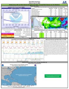
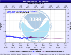
The Brazos River in Richmond is currently at Gage Elevation 8.86. Based on the 7-day extended forecast, no flooding along the Brazos River through Fort Bend County is anticipated.


This Week
This week should be similar to last week with sunny to mostly sunny skies with minimal to no rain chances.B Our high temperatures will be in the mid- to upper 90s with our low temperatures in the low 70s. Based on the current 7-Day Quantitative Precipitation Forecast (QPF), the lower Brazos River Watershed, including Fort Bend County, could see less than a B< inch of rainfall over the next 7 days.

Increased Atlantic Activity
Over the past 24 to 48 hours we have seen an increased amount of activity in the Atlantic. The NHC is currently tracking 2 disturbances in the Atlantic that are moving in a westerly direction toward the United States. Tropical Disturbance No.1, Invest 97L, moved into the eastern Caribbean Sea overnight and continues to push west. The NHC gives this system a 70% chance of developing into a Tropical System in the next 5 Days. An area of high pressure near Bermuda could push this system further west toward the western Caribbean coming close to the Yucatan Peninsula over the weekend. Once it reaches that point, an area of low pressure of the Eastern/Central United States could pull this system in a more northerly direction toward the Mississippi Valley.B Tropical Disturbance No. 2, Invest 98L, is behind Invest 97L, moving through the Atlantic. The NHC gives this system a 90% chance of developing into a Tropical System in the next 5 Days. The current round of modeling shows Invest 98L continuing in a westerly direction. While Invest 97L should follow a path south of the Caribbean Islands, Invest 98L is currently being shown to travel directly over the islands or slightly north towards Florida. It is too early to tell if and how these systems will impact the Texas Coast, but we are continuing to monitor the conditions. There is the potential that one of these systems moves into the Gulf of Mexico, but the exact location is unknown.
The District along with our District Engineer and Operator are continuing to monitor the conditions throughout the week. We encourage everyone to stay informed by visiting your favorite local weather source, including the National Weather Service, the National Hurricane Center, and West Gulf River Forecast Center. If you have not ready down so, please remember to sign up for Emergency Updates from Fort Bend County.

Reservoir Status


