Fort Bend County Levee Improvement District No. 14 is a conservation and reclamation district created by the Commissioners Court of Fort Bend County, Texas, on July 2, 1996, and operates pursuant to Chapters 49 and 57 of the Texas Water Code, as amended, and other general statutes applicable to conservation and reclamation districts.
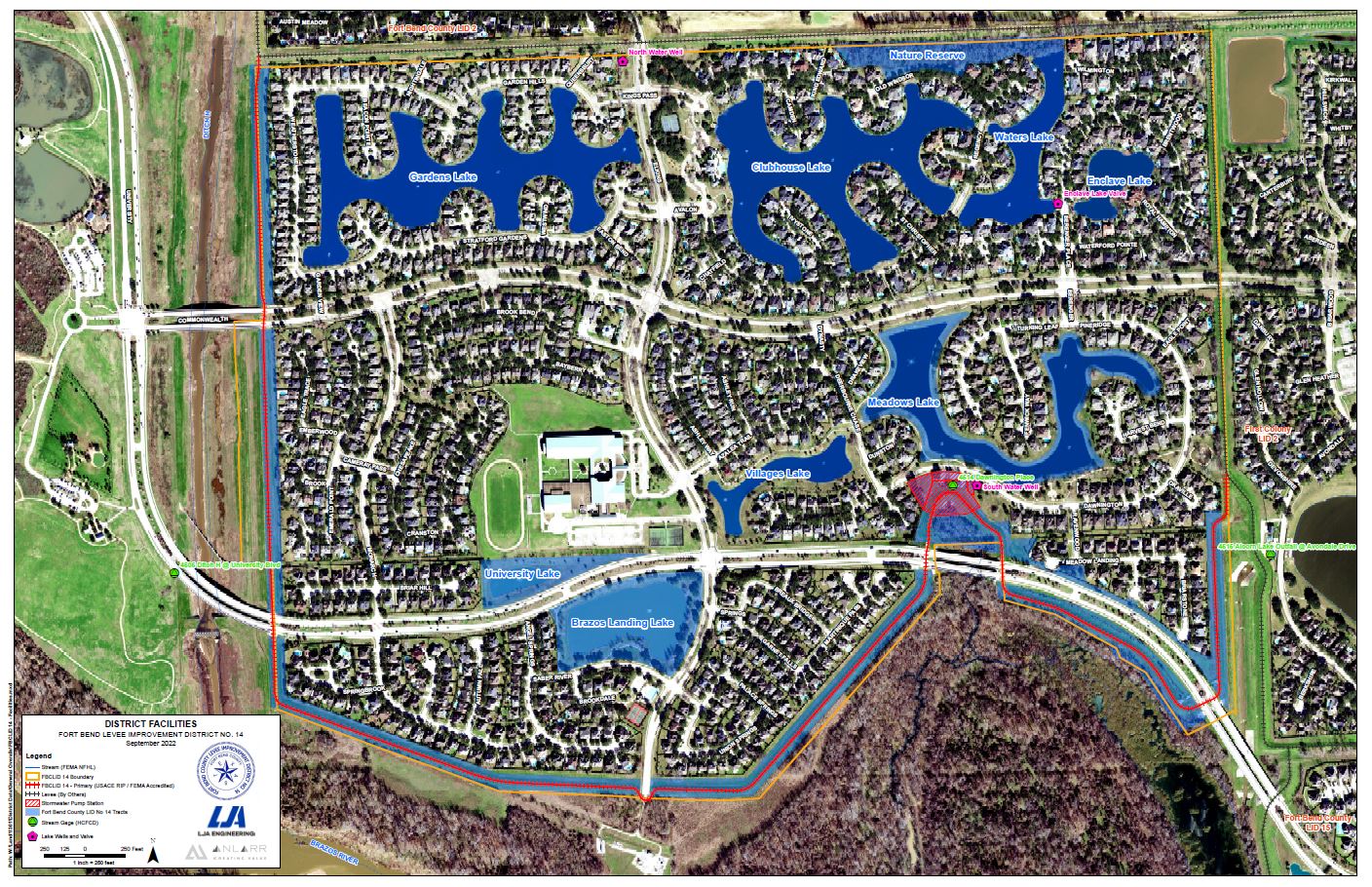
The District consists of approximately 567 acres of land and is located within the corporate limits of the City of Sugar Land. The purpose of the District is to operate and maintain approximately 2.5 miles of earthen levee, 26 acres of lakes and green space, and a storm water pump station. These improvements provide flood protection from the Brazos River. The District is also responsible for maintaining the 26 acres of lakes and green space and several fountains within the District. One of the District’s biggest maintenance issues is cleaning out resident trash and yard debris. To help maintain the lake water quality and reduce the annual costs of maintenance, the District asks all residents to respect our lakes and keep yard debris such as grass clippings out of the lakes. In addition, the District is only responsible for bulkheads around the Meadows, Villages, University, and Brazos Landing Lakes. Residents around the other lakes are responsible for maintaining the bulkheads along their property.
If residents notice any issues on the levee, lakes, or fountains, please contact the District through our Contact Form or via email info@fbclid14org.
The District general meets on the 2nd Monday of every month at the Avalon Clubhouse. Occasionally, the District will schedule special meetings or reschedule its monthly meetings. All agendas and meeting minutes are posted on the District’s website.
District Map
View a map of our district (click here to open).
Sugarstone Perimeter System
In 2007, the District joined 6 other levee districts along the Brazos River. As a perimeter system, the Districts were able to save time and public funds to address changes to the Brazos River floodplain. The System was certified by the various Districts’ Engineers and is accredited by FEMA for protection from the 1% Annual Chance Flood Hazard (100-Year Storm).
Today, each District operates and maintains its own portion of the perimeter system based on standards defined by the United States Army Corps of Engineers (USACE). In addition, the system is part of the USACE’s PL84-99 Program, which allows the Districts to request emergency support from the USACE during natural disasters.