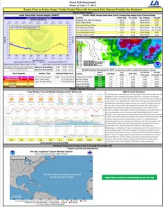
The Brazos River in Richmond is currently at Gage Elevation 11.9. Based on the 7-day extended forecast, no flooding along the Brazos River through Fort Bend County is anticipated.


This Week
The main story for this week is the possibility of some tropical activity forming in and moving across the Gulf of Mexico this week. The exact impacts and locations are still uncertain, but the closest system will bring some much-needed rain to portions of southeast Texas. For the next 7 days, high temperatures will be in the upper 80s to low 90s with low temperatures in the mid to upper 70s. The exact amount of precipitation from the tropical activity is unclear, but the 7-Day Quantitative Precipitation Forecast (QPF) shows the lower portions of the Brazos River watershed receiving between 0.5 and 1.25 inches of rainfall over the next 7 days.

Tropical Outlook
From our partners at HCFCD, here is a summary of the two disturbances we are tracking:
- System Closest to Texas Coast (NHC Disturbance No. 3): Tropical wave that has been moving across the Gulf of Mexico is located just off the upper TX coast this morning. Radar images from Lake Charles and Houston indicate that a weak area of surface low pressure has formed south of Sabine Pass and is moving toward the WNW. This feature will make landfall along the upper TX coast later today with a corresponding increase in showers and thunderstorms. Some of the rainfall will be heavy, especially near the coast and south of I-10. No additional development of this feature is likely before moving inland.
- System North of Cuba (NHC Disturbance No. 1) : A tropical wave near eastern Cuba will move WNW into the SE Gulf of Mexico on Tuesday, the central Gulf on Wednesday, and the NW Gulf Thursday into Friday. While the system is currently disorganized and there are no signs of any surface low pressure, conditions in the central and western Gulf of Mexico appear generally favorable for some slight development of this wave later this week. There is some weak model support in the global models and some of their ensemble runs that suggest weak low pressure may develop near the TX coast as the wave axis begins to move inland on Friday. NHC currently indicated a 20% chance of development Wed-Fri with this feature over the central and NW Gulf of Mexico. Regardless of development, periods of showers and thunderstorms, some with heavy rainfall will be possible Friday/Saturday along with increasing winds and seas near the coast and offshore.
With the current Tropical Activity, the District is coordinator with their Engineer and Operator who is watching the conditions for impacts to the District.
Please continue to watch your local forecasts throughout the week through trusted sources such as theB National Weather Service,B West Gulf River Forecast Center, and theB Fort Bend County Office of Homeland Security & Emergency Management.

Reservoir Status


