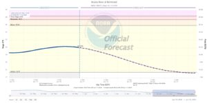
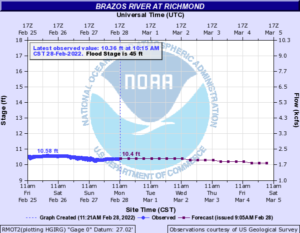
Fort Bend County Levee Improvement District 14 is actively monitoring the potential for heavy rainfall to move through the region Tuesday evening through Wednesday morning. Below is an update from the NWS Houston/Galveston Office.
Isolated to scattered showers and thunderstorms will continue through the afternoon, but then a line of strong thunderstorms will develop this evening and slowly move through the area later this evening. There is a Flash Flood Watch in effect from 7pm this evening through 7am Wednesday morning.

Overview
There will be isolated to scattered showers and thunderstorms through the afternoon today mainly south of I-10 that may produce isolated spots of 1 to 2 inches. However, the main concern will be from a line of storm thunderstorms that will develop over the northwestern portion of the region this evening and slowly move eastward through tomorrow morning. Widespread rainfall through Wednesday morning will average between 2 and 4 inches with isolated high-end amounts between 6 and 8 inches possible. The WPC has placed much of SE TX in a Slight Risk for excessive rainfall later today and tonight, and we have issued a Flash Flood Watch from 7pm this evening through 7am Wednesday morning. In addition to the heavy rain threat, the SPC has placed portions of the area in a Slight Risk for severe thunderstorms this evening and tonight with hail and strong winds possible. Confidence is high that rain will develop, but confidence in timing and location remains moderate to low since much of the activity will be driven by small scale features.

Urban Flash Flood Messaging
Heavy rainfall is forecast for portions of Southeast Texas, including highly urbanized areas like the Houston metropolitan area. Based on forecast conditions, NWS Houston will be utilizing the following urban flash flood messaging for this event:
Generally: Street Flooding (Anticipating Moderate Rainfall Rates; 1-2″/hour)
- Drive with caution. Cars may flood in low-lying areas. Ponding on roadways may increase risk of hydroplaning.
- Pay attention to the weather. Monitor the NWS, your local media, HCFCD and other official weather information sources.
- Rain may move repeatedly across the same area, causing a rapid rise on creeks and bayous. However, creeks and bayous are not likely to exceed their banks.
Isolated: “Turn Around, Don’t Drown” Flash Flooding (Anticipating High Rainfall Rates; 2-4″/hour)
- Turn Around, Don’t Drown. Isolated underpasses or low-water crossings may be life-threatening.
- Monitor the NWS, your local media, HCFCD and other official weather information sources.
The District encourages everyone to follow good flood safety standards and stay informed through trusted sources such as the National Weather Service, West Gulf River Forecast Center, and the Fort Bend County Office of Homeland Security & Emergency Management.


