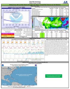
Over the past 24 hours, Potential Tropical Cyclone Two has continued to slowly develop and is expected to become a tropical depression later today. Based on this morningb�s forecast, it could develop into a Tropical Storm on Friday and possibly a Hurricane late Friday or Saturday morning. There still remains some uncertainty in the ultimate track; however, confidence continues to grow that the system will make landfill near the central part of Louisiana. B Flooding as already occurred in portions of Louisiana with an additional 10 to 15 inches with isolated amounts of 20 inches as the result of this system expected over the next several days.
B
Locally, the impacts to Fort Bend County and the areas west of Houston should be minimal. This morningb�s forecast is showing our area receiving less than one inch through Tuesday morning. We will continue to monitor for any changes in the track and intensity which can have an impact on final rainfall amounts.
B
Although this system is showing signs of being less impactful to our area, we continue to encourage residents to:
- Monitor Forecasts Twice a Day. The NHC has developed a simple video on understanding Hurricane Forecasts (below) which can also be viewed on theirB YouTube Channel.
- Check and stock hurricane kits and have plans ready. You may not need it for this system, but it is still a good opportunity to be prepared before the next one. Learn more about emergency kits by visitingB Ready.Gov/Build-a-Kit
. - Follow trusted weather sources for information (National Hurricane Center,B Houston/Galveston National Weather Service,B West Gulf River Forecast CenterB andB Fort Bend County Office of Homeland Security & Emergency Management) for any recommendations and changes in forecasts.
- Only share credible information from trusted weather sources.


