After a period of severe weather, the region is expected to get some relief later today which should run through the weekend. As of this morning, the lower Brazos River watershed received between 0.2 to over 4 inches with the Bryan/College Station area receiving the heaviest amounts of rainfall. Overnight the Brazos River through Bryan outpaced yesterday evenings forecast due to higher than predicted rainfall amounts which caused flash flooding conditions in the Bryan/College Station area. This has resulted in higher predictions for gages downstream of the Bryan gage.
As of this morning the Hempstead, Richmond, and Sugar Land Gages are in Action Stage and continuing to rise. Below are the hydrographs from this morning’s forecasts.
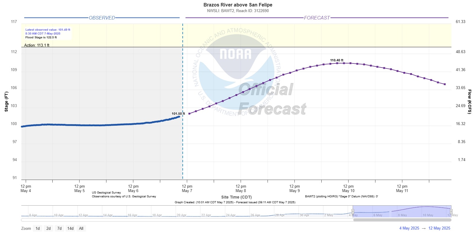
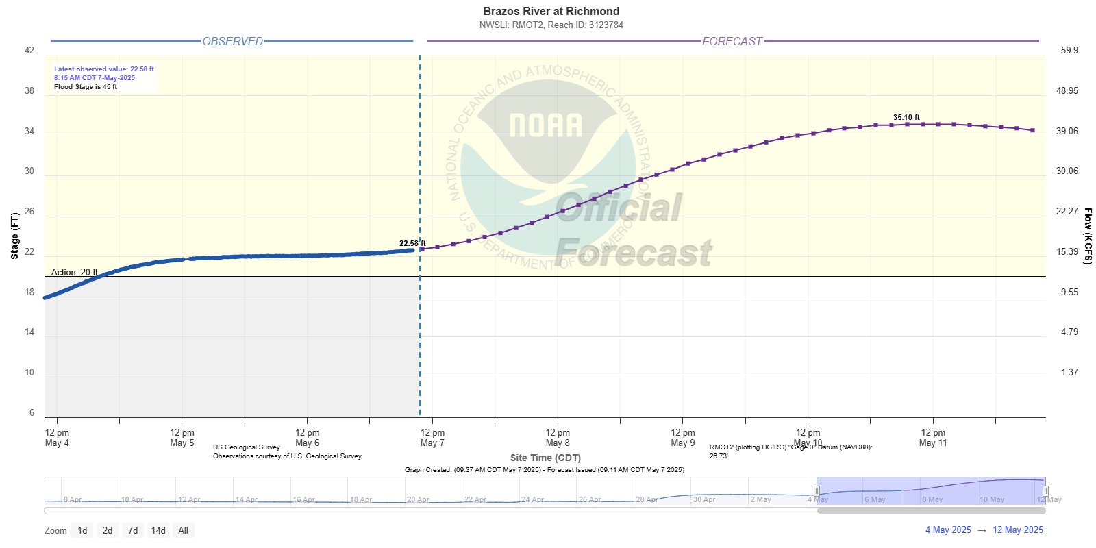
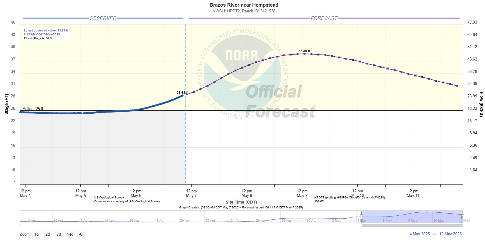
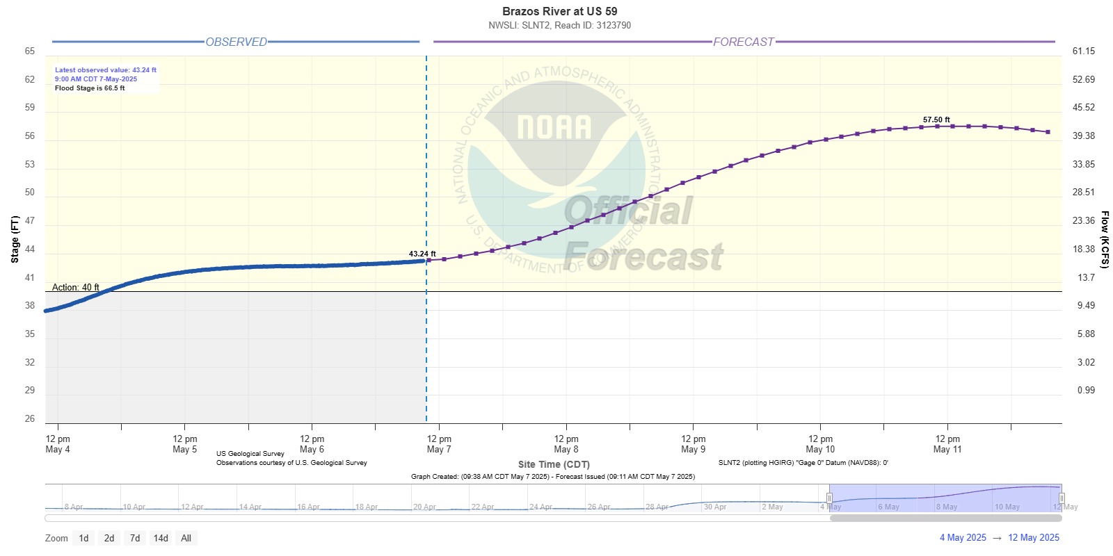
With rain chances reducing, we should see less variation in the forecasts; however, as water from the upper portions of the Brazos River works its way downstream forecasts can change. The main concern now would be rainfall that could occur while the Brazos River is elevated. Good news is that forecast through the weekend includes low chances for rain. The NWS Quantitative Precipitation Forecasts (QPF) shows the lower Brazos River receiving less than ½ inch over the next 7 days with most of that rainfall forecasted for today. After today, the QPF shows less than ¼ inch through the weekend.
District personnel will continue to monitor forecasts and conditions within the District while the Brazos River continues to be elevated. The District does not anticipate pumping due to the current rainfall potential; however, the District personnel are ready to operate the station if needed. If residents have any concerns or questions, please contact the District at https://fbclid14.org/contact/.