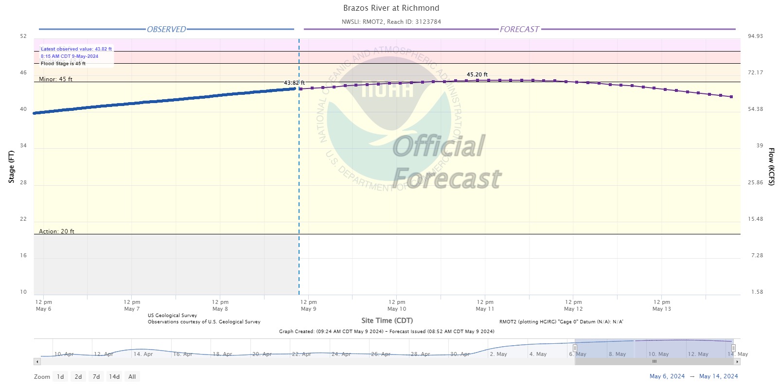
As of 8:15 AM on May 9, 2024, the Brazos River in Richmond is in Action Stage and is currently at Gage Elevation 43.82 feet and rising. According to the 8:52 AM forecast, the WGRFC anticipates the Brazos River cresting around Gage Elevation 45.2 feet on Saturday. This puts the Brazos River through Richmond slightly above Minor Flood Stage. Looking further upstream, the Hempstead Gage should crest today. It is currently at Gage
Elevation 46.52 with a forecast crest of 46.9. The San Felipe Gage should crest
on Friday. It is currently at Gage Elevation 117.71 with a crest of 118.8’. Based on the forecasts, areas along the Brazos River through Fort Bend County could see another 1 to 2 feet of rise through Sunday before water levels start to fall. Please note due to the hydraulics of the Brazos River and the distance between forecast points, some areas could see slightly less or slightly more than this estimate.
As mentioned yesterday, while the Brazos River is elevated, we focus even more on our rain chances as low areas and drainage facilities could have reduced capacity. Conditions continue to support the risk for heavy rainfall starting Sunday afternoon into Monday. This morning’s forecast shows the heaviest rain potentially along and north of I-10, but everyone should continue to monitor forecasts as we approach Sunday. Final locations and
amounts could vary. As of this morning, the Quantitative Precipitation Forecast
(QPF) is showing the lower Brazos River Watershed receiving between 1 to 3
inches of rain over the next 7 days. The majority of this could occur Sunday
into Monday. Based on the current forecast, no major flooding due to the Brazos
River through Fort Bend County is anticipated; however low laying areas could
be impacted.
Based on the current forecast, the District does not anticipate emergency operations; however, the District’s team is continuing to monitor conditions along the Brazos River and within the District and is ready to respond as needed. Please note, forecasts and conditions can change. Everyone is encouraged to stay weather aware by following their favorite local weather source, including the National Weather Service and the West Gulf
River Forecast Center. If you have not ready done so, please remember to sign up for Emergency Updates from Fort Bend County.
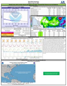
Flood Risk Assessment Attached


